

Maps
in the News: Historic Salem, Massachusetts
The
Ball State University Libraries GIS Research and Map Collection (GRMC) houses
over 140,000 maps, atlases, and other cartographic resources on the second
floor of Bracken Library. The collection
includes historic and modern maps of places around the world and may be used
for research and learning.
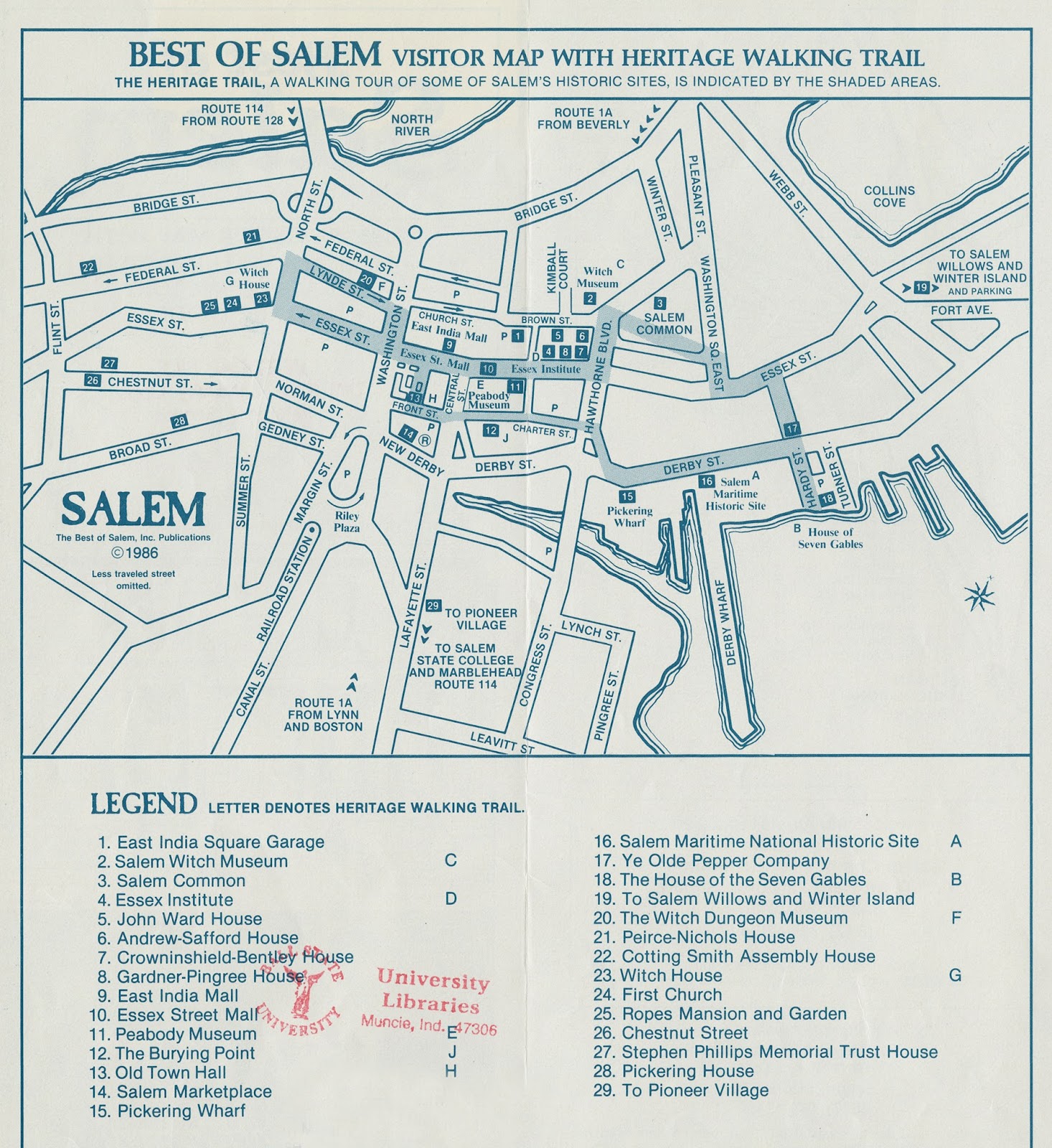
The
GRMC includes a variety of maps depicting the historic town of Salem,
Massachusetts. Best of Salem, Massachusetts map (top, click to enlarge) includes a
visitor map with the Heritage Walking Trail depicted in shading. The verso includes an inset map of the
general area near Salem and a business directory.
Historic Salem Massachusetts was published by
the Salem Chamber of Commerce. The map identifies points of interest and
information about the Salem Witch Museum.
The verso of the map includes photographs of the important places during
the Salem witch trials like The Burying Point, the home of Judge Jonathan
Corwin, and the Salem Witch Museum.
Maps
from the GRMC may be borrowed for two weeks or longer. For more information, please contact the GRMC
at 765-285-1097.
No comments:
Post a Comment